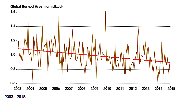
I apologize in advance that global wildfire acres burned data in the chart below end in 2015. When NASA finds something interesting with their satellites, that contradicts the CO2 is evil climate alarmism, they may publish it once, and then never update it. That happened with a study of the Earth greening from more CO2 in the atmosphere -- data from 2016 (next two charts).
NASA weather satellites also are used for data that create the most accurate near-global coverage, global average temperature data -- UAH. NASA ignores UAH global average temperature data because they show less warming than their surface data, "adjusted" hundreds of times every month, including lots of wild guesses ("infilling") for surface grids with no thermometers, and grids with some missing data, and also measured in an ever changing environment from economic growth and land use changes. But never mind that. I guess we should be thankful that any of this good news gets published one time by our government bureaucrats !


